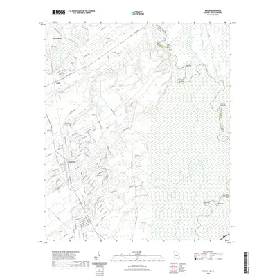
2020 Map of Rincon
USGS Topo · Published 2020About this map
The Savannah River forms a wide, complex wetland boundary along the eastern edge of this Effingham County landscape, where numerous points and lakes like Glovers Point and Coleman Lake mark the winding river corridor. Inland, the growing community of Rincon serves as a central hub, connected to Springfield and the smaller settlement of Birds by a network of historic routes including Old Augusta Rd and Ebenezer Rd. This 2020 record illustrates the proximity of modern residential development to long-established family sites, notably the Gnann Cem and Rahn Cem. The land is defined by a dense web of waterways such as Ebenezer Creek and Sweigoffer Cr, which drain the low-lying terrain into the river basin. The map even identifies the Proposed Gnann Tract A, indicating the continued evolution of land use in this coastal plain region.
Find a feature on this map
149 named features on this map. Tap any name to fly to it.
Don’t see what you’re looking for? This feature index may not catch every label — zoom into the map to look around manually.
Map Details
Editions of this 2020 Rincon Map
This is the sole edition of this map. No revisions or reprints were ever made.
Other maps of this area

1919 · Egypt
USGS Topo · 1:62,500

1920 · Hardeeville
USGS Topo · 1:62,500

1920 · Meldrim
USGS Topo · 1:62,500

1939 · Egypt
USGS Topo · 1:62,500

1942 · Meldrim
USGS Topo · 1:62,500

1942 · Savannah
USGS Topo · 1:62,500

1943 · Hardeeville
USGS Topo · 1:62,500

1943 · Egypt
USGS Topo · 1:62,500

1947 · Savannah
USGS Topo · 1:250,000

1948 · Savannah
USGS Topo · 1:250,000