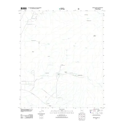
2011 Map of Rincon Peak
USGS Topo · Published 2011About this map
Agua Verde Creek flows through this corner of the Arizona desert, a landscape defined by sharp elevation changes and scattered homesteads. The terrain rises sharply to the northeast toward the heights of Rincon Peak and Wrong Mountain, while the southern reaches feature the lower-lying settlements of Marsh and Pantano near the banks of Clenega Creek. These areas show a network of rural roads such as Marsh Station Rd and Red Hill Ranch Rd, which connect isolated properties like Harrington Ranch and Rancho del Cielo. Numerous springs, including Coyote Spring and Chimney Spring, dot the canyons and provide vital water sources in this arid environment. The map captures the transitional zone between the high peaks and the drainage basins, illustrating the enduring footprint of ranching life at Harrington Place and the surrounding high-desert valleys like the Valley of the Moon.
Find a feature on this map
42 named features on this map. Tap any name to fly to it.
Don’t see what you’re looking for? This feature index may not catch every label — zoom into the map to look around manually.
Map Details
Editions of this 2011 Rincon Peak Map
This is the sole edition of this map. No revisions or reprints were ever made.
Other maps of this area

1904 · Patagonia
USGS Topo · 1:125,000

1904 · Tucson
USGS Topo · 1:125,000

1905 · Patagonia
USGS Topo · 1:125,000

1905 · Tucson
USGS Topo · 1:125,000

1915 · Benson
USGS Topo · 1:125,000

1926 · Whetstone
USGS Topo · 1:62,500

1943 · Benson
USGS Topo · 1:125,000

1945 · Happy Valley
USGS Topo · 1:62,500

1956 · Nogales
USGS Topo · 1:250,000

1956 · Tucson
USGS Topo · 1:250,000