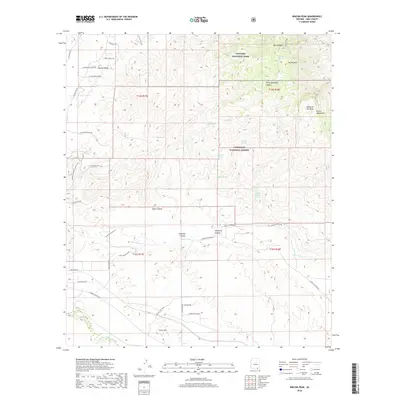
2018 Map of Rincon Peak
USGS Topo · Published 2018About this map
Saguaro National Park and the Coronado National Forest dominate this arid landscape, where the high elevations of the Rincon Mountains meet the deep drainages of Posta Quemada Canyon and Shaw Canyon. The terrain is defined by dramatic relief, rising from the Rincon Valley up to Rincon Peak and Wrong Mtn. Water remains a central geographic feature in this desert environment, marked by numerous named points including Bear Wallow Spring, Lion Spring, and Coyote Spring. The Arizona National Scenic Trail traverses the western slopes, crossing historical routes like E Old Spanish Trl. The network of local roads such as Rancho Kulvato Rd and E Marsh Station Rd provides a detailed look at the interface between protected federal lands and private ranching interests in Pima County.
Find a feature on this map
50 named features on this map. Tap any name to fly to it.
Don’t see what you’re looking for? This feature index may not catch every label — zoom into the map to look around manually.
Map Details
Editions of this 2018 Rincon Peak Map
This is the sole edition of this map. No revisions or reprints were ever made.
Other maps of this area

1904 · Patagonia
USGS Topo · 1:125,000

1904 · Tucson
USGS Topo · 1:125,000

1905 · Patagonia
USGS Topo · 1:125,000

1905 · Tucson
USGS Topo · 1:125,000

1915 · Benson
USGS Topo · 1:125,000

1926 · Whetstone
USGS Topo · 1:62,500

1943 · Benson
USGS Topo · 1:125,000

1945 · Happy Valley
USGS Topo · 1:62,500

1956 · Nogales
USGS Topo · 1:250,000

1956 · Tucson
USGS Topo · 1:250,000