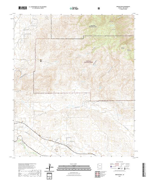
2021 Map of Rincon Peak
USGS Topo · Published 2021About this map
Saguaro National Park and the Coronado National Forest dominate this high-desert landscape, where the Rincon Mountains rise sharply above the Rincon Valley. The terrain is defined by dramatic elevation changes, moving from the low wash of Pantano Wash and Agua Verde Cr up to the high summits of Rincon Peak and Wrong Mtn. This modern survey documents a network of springs essential to life in the arid environment, including Bear Wallow Spring, Aliso Spring, and Distillery Canyon Spring. Human presence is marked by ranching-era infrastructure such as X9 Ranch Rd and Red Hill Ranch Rd, alongside the preservation of the Arizona National Scenic Trl. The map illustrates the convergence of recreational trails and historic ranch roads within a protected wilderness context.
Find a feature on this map
51 named features on this map. Tap any name to fly to it.
Don’t see what you’re looking for? This feature index may not catch every label — zoom into the map to look around manually.
Map Details
Editions of this 2021 Rincon Peak Map
This is the sole edition of this map. No revisions or reprints were ever made.
Other maps of this area

1904 · Patagonia
USGS Topo · 1:125,000

1904 · Tucson
USGS Topo · 1:125,000

1905 · Patagonia
USGS Topo · 1:125,000

1905 · Tucson
USGS Topo · 1:125,000

1915 · Benson
USGS Topo · 1:125,000

1926 · Whetstone
USGS Topo · 1:62,500

1943 · Benson
USGS Topo · 1:125,000

1945 · Happy Valley
USGS Topo · 1:62,500

1956 · Nogales
USGS Topo · 1:250,000

1956 · Tucson
USGS Topo · 1:250,000