
1956 Map of Ringgold
USGS Topo · Published 1957About this map
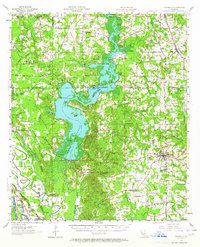
Lake Bistineau dominates the central landscape of this mid-century survey, its fingers reaching into the surrounding pine-rich parishes. The waters are dotted with family-named landforms like Peggys Island and Adam Point, while the eastern shore is anchored by Lake Bistineau State Park. The region's economy at this time is clearly defined by natural resource extraction, evidenced by the Bistineau Gasoline Plant, numerous Gas Wells, and the historic New Salt Works situated near the northern marshes.
Find a feature on this map
106 named features on this map. Tap any name to fly to it.
Don’t see what you’re looking for? This feature index may not catch every label — zoom into the map to look around manually.
Map Details
Editions of this 1956 Ringgold Map
2 editions found
Other maps of this area

1932 · Bossier SE
USGS Topo · 1:31,680

1938 · Arnsberg
USGS Topo · 1:31,680

1941 · East Point
USGS Topo · 1:31,680

1941 · Bossier Point
USGS Topo · 1:31,680

1945 · Mansfield
USGS Topo · 1:62,500

1947 · Ringgold
USGS Topo · 1:62,500

1947 · Ashland
USGS Topo · 1:62,500

1947 · Mansfield
USGS Topo · 1:62,500

1947 · Minden
USGS Topo · 1:62,500

1948 · Coushatta
USGS Topo · 1:62,500