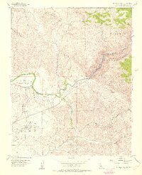
1954 Map of Rio Bravo Ranch
USGS Topo · Published 1955About this map
The Kern River carves a path through this mid-century landscape, marking the transition from the southern Sierra foothills to the expansive valley floor. Hydroelectric infrastructure is a prominent feature, with several Powerhouse installations and a network of Penstocks and an Aqueduct system following the river's descent. This development speaks to the era's focus on water management and energy production to support regional growth.
Find a feature on this map
19 named features on this map. Tap any name to fly to it.
Don’t see what you’re looking for? This feature index may not catch every label — zoom into the map to look around manually.
Map Details
Editions of this 1954 Rio Bravo Ranch Map
4 editions found
Other maps of this area

1906 · Bakersfield
USGS Topo · 1:62,500

1914 · Caliente
USGS Topo · 1:125,000

1920 · Delonagha
USGS Topo · 1:62,500

1926 · Glennville
USGS Topo · 1:62,500

1929 · Bena
USGS Topo · 1:31,680

1929 · Fairfax School
USGS Topo · 1:31,680

1931 · Edison
USGS Topo · 1:31,680

1932 · Bena
USGS Topo · 1:31,680

1932 · Fairfax School
USGS Topo · 1:31,680

1932 · Woody
USGS Topo · 1:62,500