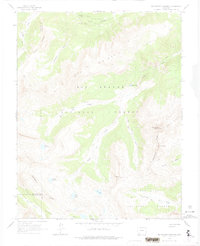
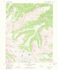
1964 Map of Rio Grande Pyramid
USGS Topo · Published 1974About this map
The Continental Divide dictates the flow of water across this high-elevation landscape in the mid-1960s, separating the headwaters of the Rio Grande from the basins of the San Juan National Forest. Centered on the iconic peak of Rio Grande Pyramid, the map details a remote wilderness accessed primarily by a network of trails such as the Pack Trail and a rugged Jeep Trail. Glacial activity is evident in the cluster of alpine water bodies, including Ute Lake, Flint Lakes, and the Twin Lakes. The terrain is characterized by sharp relief and steep drainages like Starvation Gulch and La Vaca Rincon. This survey documents the area before modern wilderness designations fully codified the land use, showing the primary transport routes along Ute Creek and its various forks that supported early backcountry exploration and resource management.
Find a feature on this map
31 named features on this map. Tap any name to fly to it.
Don’t see what you’re looking for? This feature index may not catch every label — zoom into the map to look around manually.
Map Details
Editions of this 1964 Rio Grande Pyramid Map
5 editions found
Other maps of this area

1897 · Silverton
USGS Topo · 1:62,500

1900 · Needle Mountains
USGS Topo · 1:62,500

1901 · Silverton
USGS Topo · 1:62,500

1902 · Needle Mountains
USGS Topo · 1:62,500

1902 · Silverton
USGS Topo · 1:62,500

1905 · San Cristobal
USGS Topo · 1:125,000

1907 · San Cristobal
USGS Topo · 1:125,000

1945 · Durango
USGS Topo · 1:250,000

1953 · Durango
USGS Topo · 1:250,000

1954 · Durango
USGS Topo · 1:250,000