
1947 Map of Rio Grande
USGS Topo · Published 1947About this map
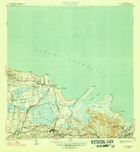
The coastal lowlands and river deltas of northeastern Puerto Rico are meticulously detailed in this survey from the 1940s. The inland town of Rio Grande serves as a central hub, surrounded by a network of sugar-producing agricultural settlements known as colonias. These include Colonia Miñi, Colonia Dolores, and Colonia Blasina, which signify the region's historical economic reliance on the sugar industry and labor communities. The landscape is defined by the winding paths of the Río Grande de Loíza and the Río Espíritu Santo, which empty into the Océano Atlántico. Along the shoreline, prominent landmarks like Pta Miquillo and Pta Picúa frame the Ensenada Comezón. The map also captures local infrastructure such as State Route 3 and State Route 187, connecting coastal hamlets like Poblado Honduras to the interior.
Find a feature on this map
46 named features on this map. Tap any name to fly to it.
Don’t see what you’re looking for? This feature index may not catch every label — zoom into the map to look around manually.
Map Details
Editions of this 1947 Rio Grande Map
3 editions found
Other maps of this area

1940 · Carolina
USGS Topo · 1:30,000

1941 · Rio Grande
USGS Topo · 1:30,000

1941 · Carolina
USGS Topo · 1:30,000

1945 · El Yunque
USGS Topo · 1:30,000

1946 · El Yunque
USGS Topo · 1:30,000

1946 · Gurabo
USGS Topo · 1:30,000

1946 · Fajardo
USGS Topo · 1:30,000

1947 · Carolina
USGS Topo · 1:30,000

1947 · El Yunque NE
USGS Topo · 1:10,000

1947 · Gurabo NE
USGS Topo · 1:10,000