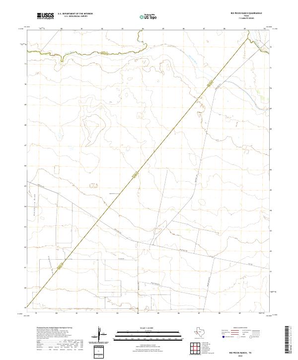
2022 Map of Rio Pecos Ranch
USGS Topo · Published 2022About this map
The Pecos River forms a defining natural boundary at the northern edge of this West Texas landscape, where the borders of Ward, Reeves, and Pecos counties converge. The terrain is characterized by broad drainage patterns including Hackberry Draw and Coyanosa Draw, highlighting the arid hydrology of the region. This 2022 survey illustrates a sparse ranching and utility-focused environment, marked by an intersection of local transit routes such as El Paso Rd and Ranch Rd 1450.
Find a feature on this map
13 named features on this map. Tap any name to fly to it.
Don’t see what you’re looking for? This feature index may not catch every label — zoom into the map to look around manually.
Map Details
Editions of this 2022 Rio Pecos Ranch Map
This is the sole edition of this map. No revisions or reprints were ever made.
Other maps of this area

1931 · Barstow
USGS Topo · 1:125,000

1954 · Pecos
USGS Topo · 1:250,000

1957 · Pecos
USGS Topo · 1:250,000

1963 · Ligon Ranch
USGS Topo · 1:24,000

1963 · China Lake NE
USGS Topo · 1:24,000

1963 · Rio Pecos Ranch
USGS Topo · 1:24,000

1963 · China Lake
USGS Topo · 1:24,000

1969 · 7 L Ranch
USGS Topo · 1:24,000
1973 · Coyanosa NW
USGS Topo · 1:24,000
1974 · Coyanosa
USGS Topo · 1:24,000