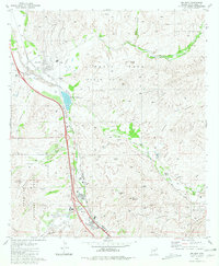
1981 Map of Rio Rico
USGS Topo · Published 1981About this map
The Luis Maria Baca (Float No 3) land grant dominates the northern half of this landscape, reflecting a complex history of private Mexican land claims that persisted through the American territorial period. Along the banks of the Santa Cruz River, the presence of the Guevavi Mission (Ruins) and the Calabasas (Site) marks centuries of settlement at the confluence with Sonoita Creek. These sites, situated near the Southern Pacific railroad corridor, illustrate the long-standing strategic importance of this valley for transit and trade.
Find a feature on this map
38 named features on this map. Tap any name to fly to it.
Don’t see what you’re looking for? This feature index may not catch every label — zoom into the map to look around manually.
Map Details
Editions of this 1981 Rio Rico Map
2 editions found
Other maps of this area

1904 · Patagonia
USGS Topo · 1:125,000

1905 · Patagonia
USGS Topo · 1:125,000

1905 · Nogales
USGS Topo · 1:125,000

1920 · Arivaca
USGS Topo · 1:125,000

1921 · Old Glory
USGS Topo · 1:125,000

1922 · Agus Caliente
USGS Topo · 1:62,500

1933 · Calabasas
USGS Topo · 1:62,500

1939 · Tubac
USGS Topo · 1:62,500

1942 · Ruby
USGS Topo · 1:62,500

1943 · Old Glory
USGS Topo · 1:125,000