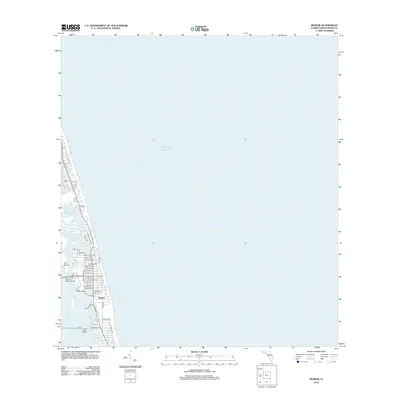
2012 Map of Riomar
USGS Topo · Published 2012About this map
The coastal community of Riomar occupies a narrow barrier island between the Atlantic Ocean and the Indian River in this 2012 survey. This geography is defined by a complex network of coastal waterways and islands, including Fritz Island, Farley Island, and the sheltered waters of McCullers Cove and Jandrew Cove. The map provides a detailed look at the residential grid, where street names often reflect the local flora, such as Azalea Ln, Banyan Rd, and Bougainvillea Ln. Transportation between the mainland and the barrier island is facilitated by the Merrill P Barber Bridge, while the southern end of the quadrangle shows the transition toward E Causeway Blvd and Dark Point. The inland waterway is further marked by the Gifford Cut, a key navigational feature for those tracing the maritime development of this Florida coastline.
Find a feature on this map
41 named features on this map. Tap any name to fly to it.
Don’t see what you’re looking for? This feature index may not catch every label — zoom into the map to look around manually.
Map Details
Editions of this 2012 Riomar Map
This is the sole edition of this map. No revisions or reprints were ever made.
Other maps of this area

1948 · Riomar
USGS Topo · 1:24,000

1948 · Indrio
USGS Topo · 1:24,000

1949 · Vero Beach
USGS Topo · 1:24,000

1949 · Sebastian
USGS Topo · 1:24,000

1949 · Oslo
USGS Topo · 1:24,000

1950 · Riomar
USGS Topo · 1:24,000

1950 · Oslo
USGS Topo · 1:24,000

1950 · Indrio
USGS Topo · 1:24,000

1950 · Vero Beach
USGS Topo · 1:24,000

1951 · Sebastian
USGS Topo · 1:24,000