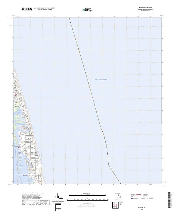
2024 Map of Riomar
USGS Topo · Published 2024About this map
Vero Beach and Indian River Shores anchor this contemporary view of the Florida coastline, where the barrier island meets the Atlantic Ocean. The landscape is defined by the intricate network of the Indian River Lagoon and the Intracoastal Waterway, which separate the mainland from islands like Fritz Island and Farley Island. This modern survey reveals a highly developed residential shoreline where streets like Banyan Rd and Azalea Ln weave through the coastal communities of Riomar.
Find a feature on this map
49 named features on this map. Tap any name to fly to it.
Don’t see what you’re looking for? This feature index may not catch every label — zoom into the map to look around manually.
Map Details
Editions of this 2024 Riomar Map
This is the sole edition of this map. No revisions or reprints were ever made.
Other maps of this area

1948 · Riomar
USGS Topo · 1:24,000

1948 · Indrio
USGS Topo · 1:24,000

1949 · Vero Beach
USGS Topo · 1:24,000

1949 · Sebastian
USGS Topo · 1:24,000

1949 · Oslo
USGS Topo · 1:24,000

1950 · Riomar
USGS Topo · 1:24,000

1950 · Oslo
USGS Topo · 1:24,000

1950 · Indrio
USGS Topo · 1:24,000

1950 · Vero Beach
USGS Topo · 1:24,000

1951 · Sebastian
USGS Topo · 1:24,000