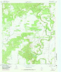
1964 Map of Riomedina
USGS Topo · Published 1982About this map
The Medina Canal and its intricate network of irrigation siphons define the agricultural landscape of Medina County in this mid-1960s study. Centered on the settlement of Riomedina, the area is dominated by the meandering course of the Medina River and its numerous tributaries, including Quihi Creek, Opossum Creek, and Yellow Creek. These waterways cut through a terrain of low hills and plains, with Indian Hill serving as a primary local landmark.
Find a feature on this map
19 named features on this map. Tap any name to fly to it.
Don’t see what you’re looking for? This feature index may not catch every label — zoom into the map to look around manually.
Map Details
Editions of this 1964 Riomedina Map
2 editions found
Other maps of this area

1954 · San Antonio
USGS Topo · 1:250,000

1956 · New Fountain
USGS Topo · 1:62,500

1956 · Bandera
USGS Topo · 1:62,500

1956 · Medina Lake
USGS Topo · 1:62,500

1957 · San Antonio
USGS Topo · 1:250,000

1958 · La Coste
USGS Topo · 1:24,000

1958 · La Coste NE
USGS Topo · 1:24,000

1964 · Riomedina
USGS Topo · 1:24,000

1964 · Castroville
USGS Topo · 1:24,000

1964 · Timber Creek
USGS Topo · 1:24,000