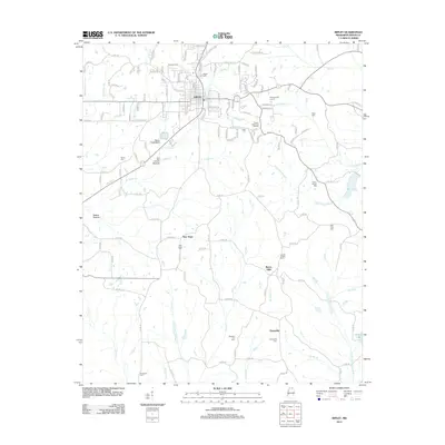
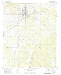
2012 Map of Ripley
USGS Topo · Published 2012About this map
Ripley serves as the focal point for this Tippah County survey, where the town's grid expands outward into the drainage basins of the Little Hatchie River and Little Tallahatchie River. The landscape is a network of small creeks and branches, including Town Cr and Cook Cr, which historically dictated the placement of early settlements and roads. Genealogists will find a high density of burial sites throughout the rural outskirts, from the prominent Tippah Memorial Gardens to smaller community grounds like Jacobs Chapel Cem, Fellowship Cem, and Academy Cem. The southern reaches of the map highlight the rural hamlets of Clarysville and Buena Vista, situated near the headwaters of Cane Cr. These scattered communities, along with features like Dumas Lake and Adkins Bottom, illustrate the transition from the concentrated commercial center of the county seat to the well-established farming and timber lands of northern Mississippi.
Find a feature on this map
139 named features on this map. Tap any name to fly to it.
Don’t see what you’re looking for? This feature index may not catch every label — zoom into the map to look around manually.
Map Details
Editions of this 2012 Ripley Map
This is the sole edition of this map. No revisions or reprints were ever made.
Other maps of this area

1950 · Ashland
USGS Topo · 1:62,500

1951 · Walnut
USGS Topo · 1:62,500

1955 · Ripley
USGS Topo · 1:62,500

1955 · Blue Mountain
USGS Topo · 1:62,500

1956 · Tupelo
USGS Topo · 1:250,000

1958 · Tupelo
USGS Topo · 1:250,000
1982 · Keownville
USGS Topo · 1:24,000
1982 · Dumas
USGS Topo · 1:24,000
1982 · Pleasant Ridge
USGS Topo · 1:24,000
1982 · Ripley
USGS Topo · 1:24,000