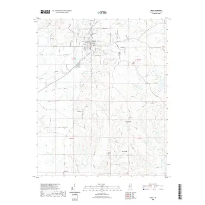
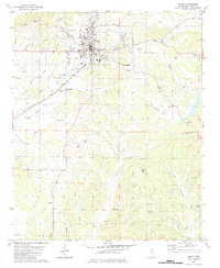
2020 Map of Ripley
USGS Topo · Published 2020About this map
Ripley serves as the regional hub of Tippah County, dominated by the civic presence of the Tippah County Courthouse and the Tippah County Chancery Building. The town's grid is bounded by Town Creek and S Tippah Creek, with residential expansion extending toward Tippah Memorial Gardens. Beyond the municipal center, the landscape transitions into a series of agricultural bottomlands, most notably Green Bottom and Adkins Bottom.
Find a feature on this map
134 named features on this map. Tap any name to fly to it.
Don’t see what you’re looking for? This feature index may not catch every label — zoom into the map to look around manually.
Map Details
Editions of this 2020 Ripley Map
This is the sole edition of this map. No revisions or reprints were ever made.
Other maps of this area

1950 · Ashland
USGS Topo · 1:62,500

1951 · Walnut
USGS Topo · 1:62,500

1955 · Ripley
USGS Topo · 1:62,500

1955 · Blue Mountain
USGS Topo · 1:62,500

1956 · Tupelo
USGS Topo · 1:250,000

1958 · Tupelo
USGS Topo · 1:250,000
1982 · Keownville
USGS Topo · 1:24,000
1982 · Dumas
USGS Topo · 1:24,000
1982 · Pleasant Ridge
USGS Topo · 1:24,000
1982 · Ripley
USGS Topo · 1:24,000