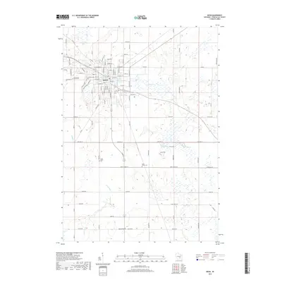
2018 Map of Ripon
USGS Topo · Published 2018About this map
Ripon serves as the focal point of this Fond du Lac County landscape, where the historic campus of Ripon College sits near the heart of the community. The town's layout is defined by a dense network of streets including W Fond du Lac St and E Oshkosh St, which transition into a rural agricultural expanse of glacial drumlins and wetlands. Water features are prominent throughout the area, from the Gothic Millpond to the winding course of the Grand River and Silver Cr. Genealogists and local historians will find significant value in the distribution of burial sites across the countryside, including the Woodlawn Cem, Saint Patrick's Catholic Cem, and the small Swatz Family Plot located south of the main settlement. The topography is marked by distinct landmarks such as Scott Hill and the open area of Round Prairie.
Find a feature on this map
87 named features on this map. Tap any name to fly to it.
Don’t see what you’re looking for? This feature index may not catch every label — zoom into the map to look around manually.
Map Details
Editions of this 2018 Ripon Map
This is the sole edition of this map. No revisions or reprints were ever made.
Other maps of this area

1916 · Ripon
USGS Topo · 1:48,000

1918 · Ripon
USGS Topo · 1:62,500

1955 · Waupun
USGS Topo · 1:62,500

1955 · Fox Lake
USGS Topo · 1:62,500

1956 · Ripon
USGS Topo · 1:62,500

1956 · Rosendale
USGS Topo · 1:62,500

1957 · Madison
USGS Topo · 1:250,000

1960 · Madison
USGS Topo · 1:250,000

1975 · Waupun NW
USGS Topo · 1:24,000

1980 · Fond Du Lac
USGS Topo · 1:100,000