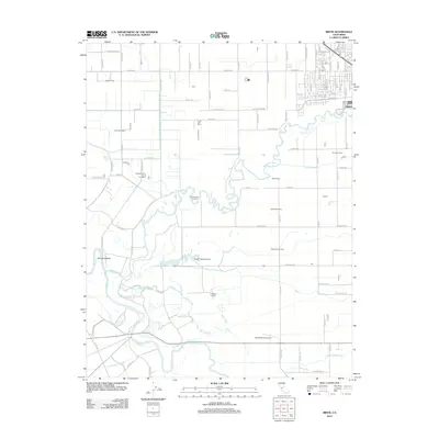
2012 Map of Ripon
USGS Topo · Published 2012About this map
The Stanislaus River and the San Joaquin River converge in this agricultural landscape of San Joaquin County, defining a complex system of waterways and fertile plains. The map records a distinct pattern of dairy farming and ranching, with numerous named family-run operations such as Fiscalini Farms, Dutra Farms, and the Roest Family Dairy spread across the grid of rural roads. The southern portion of the sheet is marked by the winding course of the Riley Slough and the Hetch Hetchy Aqueduct, which cuts a straight line through the valley's drainage network. Aviation and conservation interests are represented by private facilities like Mapes Ranch Airport and the protected Blue Heron Rookery, while the town of Ripon sits at the northeastern edge, its grid of streets such as N Wilma Ave and Otis Dr meeting the open farmland.
Find a feature on this map
91 named features on this map. Tap any name to fly to it.
Don’t see what you’re looking for? This feature index may not catch every label — zoom into the map to look around manually.
Map Details
Editions of this 2012 Ripon Map
This is the sole edition of this map. No revisions or reprints were ever made.
Other maps of this area

1913 · Romain
USGS Topo · 1:31,680

1914 · Manteca
USGS Topo · 1:31,680

1914 · Avena
USGS Topo · 1:31,680

1915 · Vernalis
USGS Topo · 1:31,680

1915 · Lathrop
USGS Topo · 1:31,680

1915 · Ripon
USGS Topo · 1:31,680

1915 · Westport
USGS Topo · 1:31,680

1915 · Westley
USGS Topo · 1:31,680

1915 · Salida
USGS Topo · 1:31,680

1916 · Romain
USGS Topo · 1:31,680