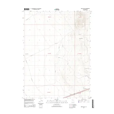
2014 Map of Ripple Valley
USGS Topo · Published 2014About this map
Grassy Mountains dominate the eastern half of this Tooele County terrain, where elevation contours reveal a sharp ascent from the desert floor. The landscape is defined by the broad basin of Ripple Valley to the west, an arid stretch marked primarily by a network of remote access roads. This 2014 survey captures the transportation infrastructure serving this isolated region, including the east-west passage of Swan Well Rd and the northern reach of Ripple Valley Rd. To the southeast, the terrain meets more modern developments indicated by Magellan Ln and Gravel Site Rd, while the southern margin shows the very edge of transit corridors like the I-80 Frontage Rd. The map illustrates the characteristic basin-and-range geography of Utah, with significant elevation changes between the valley floor and the high peaks of the eastern range.
Find a feature on this map
18 named features on this map. Tap any name to fly to it.
Don’t see what you’re looking for? This feature index may not catch every label — zoom into the map to look around manually.
Map Details
Editions of this 2014 Ripple Valley Map
This is the sole edition of this map. No revisions or reprints were ever made.
Other maps of this area

1885 · Tooele Valley
USGS Topo · 1:250,000

1953 · Tooele
USGS Topo · 1:250,000

1955 · Tooele
USGS Topo · 1:250,000

1973 · Ripple Valley
USGS Topo · 1:24,000

1973 · Grassy Mountains
USGS Topo · 1:24,000

1973 · Low
USGS Topo · 1:24,000

1973 · Aragonite NW
USGS Topo · 1:24,000

1973 · Grayback Hills
USGS Topo · 1:24,000

1973 · Finger Ridge
USGS Topo · 1:24,000

1973 · Hastings Pass
USGS Topo · 1:24,000