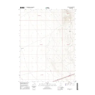
2017 Map of Ripple Valley
USGS Topo · Published 2017About this map
Ripple Valley and the Grassy Mountains define this arid landscape in Tooele County during the early 21st century. The map depicts a transitional zone where the flat expanse of the valley floor meets the rising elevations to the east. Modern infrastructure is limited to a sparse network of county roads and utility corridors, including Clive Rd and Fremont Ln. The topography is marked by clear township and range boundaries, such as t1n r11w and t1n r10w, which organize the Great Basin terrain. Several numbered secondary routes, including Tc02253 and Tc02249, navigate the slopes of the mountains, suggesting the ongoing use of this area for range management or resource access.
Find a feature on this map
15 named features on this map. Tap any name to fly to it.
Don’t see what you’re looking for? This feature index may not catch every label — zoom into the map to look around manually.
Map Details
Editions of this 2017 Ripple Valley Map
This is the sole edition of this map. No revisions or reprints were ever made.
Other maps of this area

1885 · Tooele Valley
USGS Topo · 1:250,000

1953 · Tooele
USGS Topo · 1:250,000

1955 · Tooele
USGS Topo · 1:250,000

1973 · Ripple Valley
USGS Topo · 1:24,000

1973 · Grassy Mountains
USGS Topo · 1:24,000

1973 · Low
USGS Topo · 1:24,000

1973 · Aragonite NW
USGS Topo · 1:24,000

1973 · Grayback Hills
USGS Topo · 1:24,000

1973 · Finger Ridge
USGS Topo · 1:24,000

1973 · Hastings Pass
USGS Topo · 1:24,000