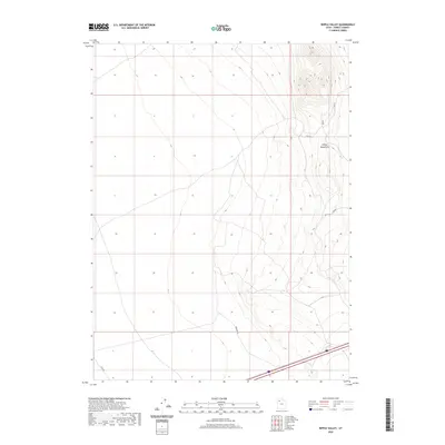
2020 Map of Ripple Valley
USGS Topo · Published 2020About this map
The eastern slopes of the Grassy Mountains define the topography of this high desert region, where steep ridgelines give way to the broad alluvial plains of Ripple Valley. Surveyed in 2020, the landscape is primarily characterized by its sparse infrastructure and vast open space. Major transportation is concentrated in the southern portion of the quadrangle, where the 80 corridor provides the primary east-west passage across Tooele County. Local access is maintained through a network of unpaved routes, including Fremont Ln and Clive Rd, alongside several designated county roads such as Tc02255 and Tc02253. The mapping of these minor tracks implies a land use focused on ranching, utility maintenance, or recreational transit within this arid Great Basin environment.
Find a feature on this map
8 named features on this map. Tap any name to fly to it.
Don’t see what you’re looking for? This feature index may not catch every label — zoom into the map to look around manually.
Map Details
Editions of this 2020 Ripple Valley Map
This is the sole edition of this map. No revisions or reprints were ever made.
Other maps of this area

1885 · Tooele Valley
USGS Topo · 1:250,000

1953 · Tooele
USGS Topo · 1:250,000

1955 · Tooele
USGS Topo · 1:250,000

1973 · Ripple Valley
USGS Topo · 1:24,000

1973 · Grassy Mountains
USGS Topo · 1:24,000

1973 · Low
USGS Topo · 1:24,000

1973 · Aragonite NW
USGS Topo · 1:24,000

1973 · Grayback Hills
USGS Topo · 1:24,000

1973 · Finger Ridge
USGS Topo · 1:24,000

1973 · Hastings Pass
USGS Topo · 1:24,000