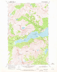
1968 Map of Rising Sun
USGS Topo · Published 1972About this map
Saint Mary Lake serves as the central anchor of this 1968 photogrammetric survey, its turquoise waters punctuated by Wild Goose Island and flanked by massive peaks. The Going-to-the-Sun Road follows the northern shoreline, providing access to landmarks like Rising Sun and Sunrift Gorge. The mapping reveals a landscape shaped by high-altitude hydrology, with numerous cascades such as Baring Falls, Virginia Falls, and Rose Falls draining the surrounding basins.
Find a feature on this map
50 named features on this map. Tap any name to fly to it.
Don’t see what you’re looking for? This feature index may not catch every label — zoom into the map to look around manually.
Map Details
Editions of this 1968 Rising Sun Map
2 editions found
Other maps of this area

1901 · Browning
USGS Topo · 1:125,000

1903 · Browning
USGS Topo · 1:125,000

1904 · Chief Mountain
USGS Topo · 1:125,000

1938 · Chief Mountain
USGS Topo · 1:125,000

1960 · Cut Bank
USGS Topo · 1:250,000

1963 · Cut Bank
USGS Topo · 1:250,000

1964 · Cut Bank
USGS Topo · 1:250,000

1968 · Saint Mary
USGS Topo · 1:24,000

1968 · Babb
USGS Topo · 1:24,000
1968 · Cut Bank Pass
USGS Topo · 1:24,000