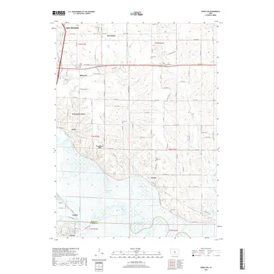
2018 Map of Rising Sun
USGS Topo · Published 2018About this map
The confluence of the Des Moines River and the North River dominates the southern reaches of this landscape east of Des Moines. Near the river bends, smaller communities like Adelphi and Hastie persist alongside several rural burial grounds including Powers Warren Cem and Wicker Cem. The terrain rises toward the north where the settlement of Rising Sun and the neighborhood of Woodland Hills mark the expanding footprint of the capital region. This 2018 survey illustrates the persistent rural character of these outlying townships, where family-named sites like Canfield Cem and Stuart Cem are still preserved amidst the grid of county roads and drainage systems like Spring Cr and Mud Cr.
Find a feature on this map
92 named features on this map. Tap any name to fly to it.
Don’t see what you’re looking for? This feature index may not catch every label — zoom into the map to look around manually.
Map Details
Editions of this 2018 Rising Sun Map
This is the sole edition of this map. No revisions or reprints were ever made.
Other maps of this area

1905 · Des Moines
USGS Topo · 1:62,500

1907 · Des Moines
USGS Topo · 1:62,500

1910 · Milo
USGS Topo · 1:62,500

1930 · Mitchellville
USGS Topo · 1:62,500

1931 · Indianola
USGS Topo · 1:62,500

1954 · Des Moines
USGS Topo · 1:250,000

1956 · Des Moines
USGS Topo · 1:250,000

1956 · Des Moines SE
USGS Topo · 1:24,000

1956 · Des Moines NE
USGS Topo · 1:24,000

1956 · Des Moines
USGS Topo · 1:62,500