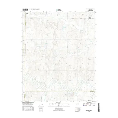
2016 Map of Ritts Junction
USGS Topo · Published 2016About this map
Ritts Junction and the surrounding Creek County countryside are defined by the convergence of several major water systems, including the wide bottomlands of the Deep Fork river. This 2016 survey illustrates a landscape of scattered rural settlements and numerous family and community burial grounds, such as the Little Creek Church Cem and the Mutte l oke-Cem. The map reveals the intricate network of section-line roads like W 311th St S and E0900 Rd that navigate around various reservoirs, including Salt-Camp Cr Site 21 Reservoir and several numbered basins. This area, situated near the western edge of the county at the Lincoln County line, maintains a distinct agricultural and rural character. The southern portion of the sheet is dominated by the wetlands of the Deep Fork, where Pettiquah Creek and Hilliby Creek join the main river channel near the settlement of Micawber.
Find a feature on this map
38 named features on this map. Tap any name to fly to it.
Don’t see what you’re looking for? This feature index may not catch every label — zoom into the map to look around manually.
Map Details
Editions of this 2016 Ritts Junction Map
This is the sole edition of this map. No revisions or reprints were ever made.
Other maps of this area

1901 · Nuyaka
USGS Topo · 1:125,000

1916 · Bristow
USGS Topo · 1:62,500

1929 · Stroud
USGS Topo · 1:62,500

1931 · Drumright
USGS Topo · 1:62,500

1932 · Stroud
USGS Topo · 1:62,500

1954 · Oklahoma City
USGS Topo · 1:250,000

1957 · Oklahoma City
USGS Topo · 1:250,000

1963 · Oklahoma City
USGS Topo · 1:250,000
1973 · Gypsy
USGS Topo · 1:24,000
1973 · Welty
USGS Topo · 1:24,000