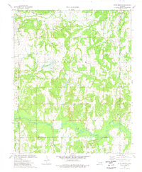
1974 Map of Ritts Junction
USGS Topo · Published 1977About this map
The St Louis-San Francisco railroad cuts through the northern corner of this Oklahoma landscape, meeting the junction at Ritts Junction. The map captures a transition between the elevated terrain of Sunny Slope and the low-lying wetlands of the Deep Fork river bottom. This river, known for its meandering course, defines the southern boundary where the borders of Creek Co and Okfuskee Co meet.
Find a feature on this map
30 named features on this map. Tap any name to fly to it.
Don’t see what you’re looking for? This feature index may not catch every label — zoom into the map to look around manually.
Map Details
Editions of this 1974 Ritts Junction Map
This is the sole edition of this map. No revisions or reprints were ever made.
Other maps of this area

1901 · Nuyaka
USGS Topo · 1:125,000

1916 · Bristow
USGS Topo · 1:62,500

1929 · Stroud
USGS Topo · 1:62,500

1931 · Drumright
USGS Topo · 1:62,500

1932 · Stroud
USGS Topo · 1:62,500

1954 · Oklahoma City
USGS Topo · 1:250,000

1957 · Oklahoma City
USGS Topo · 1:250,000

1963 · Oklahoma City
USGS Topo · 1:250,000
1973 · Gypsy
USGS Topo · 1:24,000
1973 · Welty
USGS Topo · 1:24,000