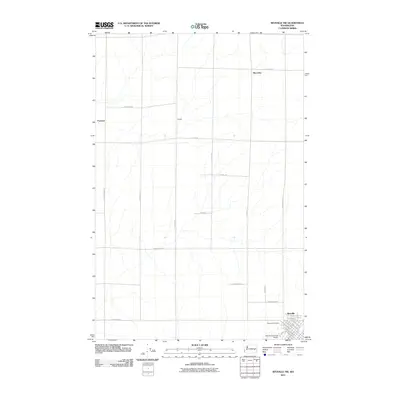
2011 Map of Ritzville NW
USGS Topo · Published 2011About this map
Ritzville serves as the primary hub in this portion of Adams County, where the grid of city streets like N Columbia St and N Division St gives way to the expansive agricultural landscape of the Columbia Plateau. The terrain is defined by a series of north-south and east-west rural routes that connect outlying points of interest such as Marcellus, Packard, and Schafer. These small locales are linked by family-named thoroughfares including N Paha Packard Rd, N Bauer Rd, and N Thiel Rd, reflecting the heritage of early settlers in this dryland farming region. South of the main settlement, the Ritzville Municipal Airport and Memorial Cemetery stand as distinct landmarks amidst the rectangular section-line road network that characterizes the development of Washington’s wheat country.
Find a feature on this map
33 named features on this map. Tap any name to fly to it.
Don’t see what you’re looking for? This feature index may not catch every label — zoom into the map to look around manually.
Map Details
Editions of this 2011 Ritzville NW Map
This is the sole edition of this map. No revisions or reprints were ever made.
Other maps of this area

1953 · Ritzville
USGS Topo · 1:250,000

1959 · Ritzville
USGS Topo · 1:250,000

1965 · Ritzville
USGS Topo · 1:250,000

1967 · Ritzville SW
USGS Topo · 1:24,000

1967 · Ritzville SE
USGS Topo · 1:24,000

1967 · Schoonover
USGS Topo · 1:24,000

1967 · Ritzville NE
USGS Topo · 1:24,000

1967 · Ritzville NW
USGS Topo · 1:24,000
1967 · Reiman SE
USGS Topo · 1:24,000

1968 · Sylvan Lake
USGS Topo · 1:24,000