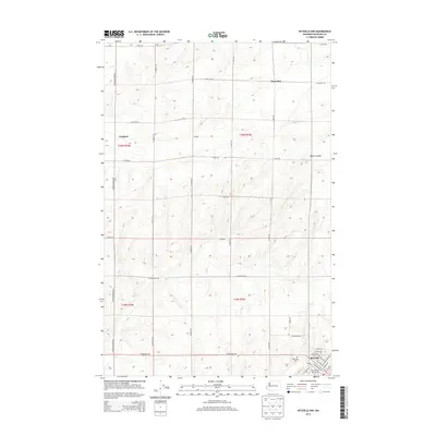
2013 Map of Ritzville NW
USGS Topo · Published 2013About this map
Ritzville serves as the focal point in the southeast corner of this survey, where the street grid expands north from E Main Ave and E Broadway Ave. The surrounding landscape of Adams County is defined by a dense network of sectional roads and the prominent geological carving of Bauer Coulee. Small rural hubs like Marcellus and Packard are visible in the northern reaches, connected by thoroughfares such as N Paha Packard Rd and N Dewald Rd. Local family roots can be traced through the Memorial Cem and various named homestead sites like Schafer. Aviation history is noted at Pru Field Airport, while the Public Land Survey System boundaries for t20n r34e, t20n r35e, and their southern counterparts organize the vast agricultural terrain of the Big Bend country.
Find a feature on this map
38 named features on this map. Tap any name to fly to it.
Don’t see what you’re looking for? This feature index may not catch every label — zoom into the map to look around manually.
Map Details
Editions of this 2013 Ritzville NW Map
This is the sole edition of this map. No revisions or reprints were ever made.
Other maps of this area

1953 · Ritzville
USGS Topo · 1:250,000

1959 · Ritzville
USGS Topo · 1:250,000

1965 · Ritzville
USGS Topo · 1:250,000

1967 · Ritzville SW
USGS Topo · 1:24,000

1967 · Ritzville SE
USGS Topo · 1:24,000

1967 · Schoonover
USGS Topo · 1:24,000

1967 · Ritzville NE
USGS Topo · 1:24,000

1967 · Ritzville NW
USGS Topo · 1:24,000
1967 · Reiman SE
USGS Topo · 1:24,000

1968 · Sylvan Lake
USGS Topo · 1:24,000