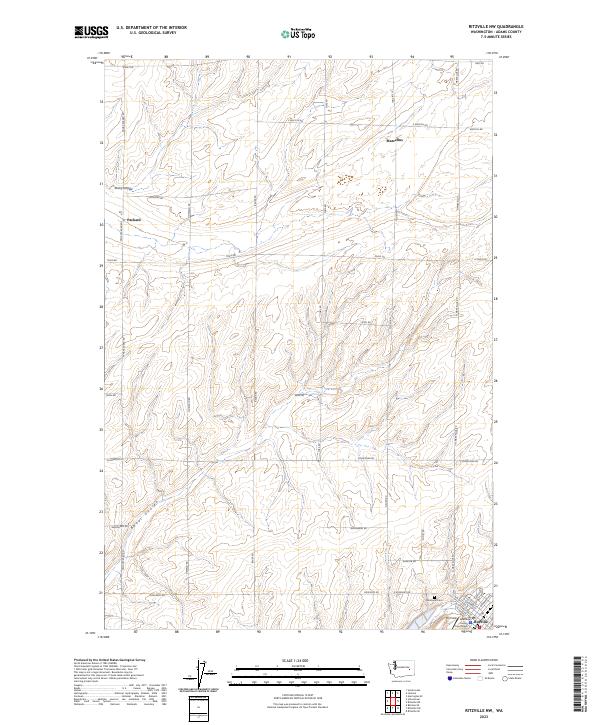
2023 Map of Ritzville NW
USGS Topo · Published 2023About this map
Ritzville serves as the focal point in this portion of the Columbia Basin, where the grid-like organization of the rural landscape meets the concentrated streets of the county seat. The map documents the northern reaches of the city, including prominent landmarks like the Adams County Courthouse and the local airfield, Pru Field. Beyond the city limits, the terrain is defined by dry watercourses such as Rocky Coulee and Bauer Coulee, which snake through the agricultural uplands. Smaller rural settlements like Marcellus and Packard are connected by a network of section-line roads, such as Paha Packard Rd and Tokio Rd, illustrating the systematic land division of eastern Washington. Genealogists may find interest in the location of Memorial Cem, situated along the northern periphery of the main settlement area.
Find a feature on this map
46 named features on this map. Tap any name to fly to it.
Don’t see what you’re looking for? This feature index may not catch every label — zoom into the map to look around manually.
Map Details
Editions of this 2023 Ritzville NW Map
This is the sole edition of this map. No revisions or reprints were ever made.
Other maps of this area

1953 · Ritzville
USGS Topo · 1:250,000

1959 · Ritzville
USGS Topo · 1:250,000

1965 · Ritzville
USGS Topo · 1:250,000

1967 · Ritzville SW
USGS Topo · 1:24,000

1967 · Ritzville SE
USGS Topo · 1:24,000

1967 · Schoonover
USGS Topo · 1:24,000

1967 · Ritzville NE
USGS Topo · 1:24,000

1967 · Ritzville NW
USGS Topo · 1:24,000
1967 · Reiman SE
USGS Topo · 1:24,000

1968 · Sylvan Lake
USGS Topo · 1:24,000