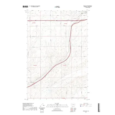
2020 Map of Ritzville SW
USGS Topo · Published 2020About this map
Ritzville stands at the northern edge of this Adams County landscape, where the basalt-carved geography of the Channeled Scablands meets the agricultural plateau of Eastern Washington. The map traces the winding course of Paha Coulee as it trends southwest toward the small settlement of Paha, a site of local significance marked by the Paha Cem. This area illustrates the transition from the structured grid of the city, including landmarks like Pru Field, to the expansive rural sections defined by a network of family-named roads such as Bauer Rd, Urquhart Rd, and Dewald Rd. In the southern reaches, the ephemeral McElroy Lake sits within the drainage patterns of the coulee, highlighting the hydraulic character of this semi-arid region where water and transportation routes have dictated development since the early homesteading era.
Find a feature on this map
36 named features on this map. Tap any name to fly to it.
Don’t see what you’re looking for? This feature index may not catch every label — zoom into the map to look around manually.
Map Details
Editions of this 2020 Ritzville SW Map
This is the sole edition of this map. No revisions or reprints were ever made.
Other maps of this area

1916 · Connell
USGS Topo · 1:125,000

1918 · Connell
USGS Topo · 1:125,000

1923 · Washtucna
USGS Topo · 1:62,500

1925 · Washtucna
USGS Topo · 1:62,500

1953 · Walla Walla
USGS Topo · 1:250,000

1953 · Ritzville
USGS Topo · 1:250,000

1958 · Walla Walla
USGS Topo · 1:250,000

1959 · Ritzville
USGS Topo · 1:250,000

1965 · Ritzville
USGS Topo · 1:250,000

1967 · Ritzville SW
USGS Topo · 1:24,000