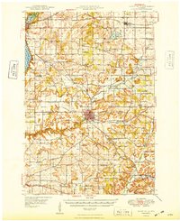
1949 Map of River Falls
USGS Topo · Published 1949About this map
River Falls sits at the heart of this landscape, where the Kinnickinnic River and its South Fork carve through the terrain of Pierce Co and St Croix Co. In the late 1940s, the region was defined by a dense network of one-room schoolhouses and rural parishes, serving a primarily agricultural community. Names like the German Settlement Cem, Cherma Ch, and Kinnickinnic Ch reflect the specific immigrant heritage of the settlers who established these townships.
Find a feature on this map
61 named features on this map. Tap any name to fly to it.
Don’t see what you’re looking for? This feature index may not catch every label — zoom into the map to look around manually.
Map Details
Editions of this 1949 River Falls Map
2 editions found
Other maps of this area

1940 · Maiden Rock
USGS Topo · 1:62,500

1944 · Red Wing
USGS Topo · 1:62,500

1946 · Hudson
USGS Topo · 1:62,500

1946 · River Falls
USGS Topo · 1:62,500

1948 · New Richmond
USGS Topo · 1:62,500

1948 · Stillwater
USGS Topo · 1:62,500

1949 · New Richmond
USGS Topo · 1:62,500

1949 · River Falls
USGS Topo · 1:62,500

1949 · Hudson
USGS Topo · 1:62,500

1949 · Baldwin
USGS Topo · 1:62,500