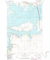
1972 Map of Riverdale North
USGS Topo · Published 1981About this map
Lake Sakakawea and Audubon Lake dominate this North Dakota landscape, showing the complex water management system north of the Garrison Dam. The vast waters of the lakes surround Mallard Island and are managed through the Snake Creek Pumping Station, reflecting a period of significant environmental and hydrologic transformation. The settlement of Riverdale sits at the southern edge near the Missouri River, serving as a central hub for the various conservation and recreation zones that define the region.
Find a feature on this map
26 named features on this map. Tap any name to fly to it.
Don’t see what you’re looking for? This feature index may not catch every label — zoom into the map to look around manually.
Map Details
Editions of this 1972 Riverdale North Map
2 editions found
Other maps of this area

1922 · Garrison
USGS Topo · 1:62,500

1929 · Coleharbor
USGS Topo · 1:62,500

1948 · Stanton
USGS Topo · 1:62,500

1949 · Stanton
USGS Topo · 1:62,500

1949 · Washburn
USGS Topo · 1:62,500

1954 · McClusky
USGS Topo · 1:250,000

1958 · McClusky
USGS Topo · 1:250,000

1961 · Underwood
USGS Topo · 1:24,000
1969 · Garrison Dam South
USGS Topo · 1:24,000
1972 · Garrison Dam North
USGS Topo · 1:24,000