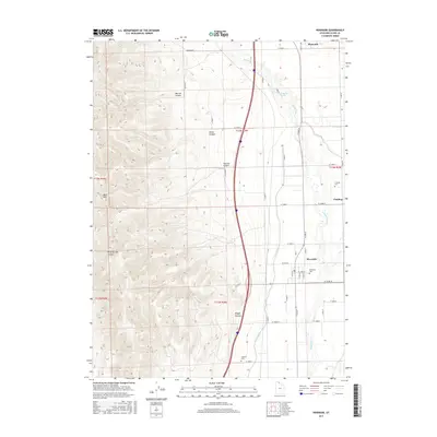
2017 Map of Riverside
USGS Topo · Published 2017About this map
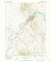
The Malad River carves through this northern Utah landscape, defining the boundary between the steep West Hills and the irrigated agricultural lands to the east. This 2017 survey details a network of water management features essential to the region's farming heritage, most notably the West Canal which parallels the river's course. Local genealogy and history are anchored by the settlements of Fielding, Riverside, and Plymouth, each accompanied by its respective burial grounds including Fielding Cem, Riverside Cem, and the Garland Cem further south. The transition from the high relief of Marlow Canyon and Butler Canyon to the valley floor is punctuated by geothermal activity at Uddy Hot Springs. The map reveals a precise grid of rural roads, such as 7600 W RD and W 20000 N, which provide access to the various canyons like Toponce Canyon and Magpie Canyon that cut into the western ridgelines.
Find a feature on this map
43 named features on this map. Tap any name to fly to it.
Don’t see what you’re looking for? This feature index may not catch every label — zoom into the map to look around manually.
Map Details
Editions of this 2017 Riverside Map
This is the sole edition of this map. No revisions or reprints were ever made.
Other maps of this area

1954 · Brigham City
USGS Topo · 1:250,000

1958 · Brigham City
USGS Topo · 1:250,000

1961 · Thatcher Mountain
USGS Topo · 1:62,500

1961 · Honeyville
USGS Topo · 1:24,000

1961 · Tremonton
USGS Topo · 1:24,000

1962 · Brigham City
USGS Topo · 1:250,000
1964 · Riverside
USGS Topo · 1:24,000
1964 · Clarkston
USGS Topo · 1:24,000
1964 · Portage
USGS Topo · 1:24,000
1964 · Cutler Dam
USGS Topo · 1:24,000