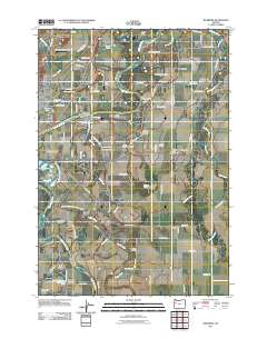
2011 Map of Riverside
USGS Topo · Published 2011About this map
Willamette River hydrology dominates this 2011 record of the corridor between Corvallis and Albany, showing a complex landscape of islands, sloughs, and agricultural research. Major landforms created by the river's shifting path include Stahlbusch Island, Kiger Island, and Truax Island, alongside smaller features like Half Moon Bend and Dead River. The agrarian character of the region is anchored by the Oregon State University Experimental Farm and specialized infrastructure such as the Dunning Vineyards Airport and Holiday Airstrip.
Find a feature on this map
90 named features on this map. Tap any name to fly to it.
Don’t see what you’re looking for? This feature index may not catch every label — zoom into the map to look around manually.
Map Details
Editions of this 2011 Riverside Map
This is the sole edition of this map. No revisions or reprints were ever made.
Other maps of this area

1911 · Tangent
USGS Topo · 1:31,680

1911 · Inavale
USGS Topo · 1:31,680

1912 · Jefferson
USGS Topo · 1:31,680

1912 · Halsey
USGS Topo · 1:62,500

1913 · Philomath
USGS Topo · 1:31,680

1913 · Oakville
USGS Topo · 1:31,680

1913 · Wells
USGS Topo · 1:31,680

1914 · Soap Creek
USGS Topo · 1:31,680

1916 · Albany
USGS Topo · 1:62,500

1921 · Corvallis
USGS Topo · 1:62,500