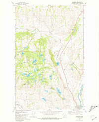
1981 Map of Riverside
USGS Topo · Published 1981About this map
The settlement of Riverside serves as a small terminal hub for the Okanogan country depicted in this 1981 survey, where the Burlington Northern railroad runs alongside Johnson Creek at the edge of the valley. The landscape is defined by the unique topography of the Coulee and the heavy concentration of small water bodies, ranging from the alkaline Alkali Lake to the uniquely named Tule Bill Lake and Medical Lake. The terrain transitions from the heights of Belt Mountain and Chilson Mountain down to the creek bottom, where various corrals and a Grave hint at the area's ranching and pioneer history.
Find a feature on this map
49 named features on this map. Tap any name to fly to it.
Don’t see what you’re looking for? This feature index may not catch every label — zoom into the map to look around manually.
Map Details
Editions of this 1981 Riverside Map
This is the sole edition of this map. No revisions or reprints were ever made.
Other maps of this area

1902 · Osoyoos
USGS Topo · 1:125,000

1904 · Osoyoos
USGS Topo · 1:125,000

1905 · Okanogan
USGS Topo · 1:125,000

1906 · Chopaka
USGS Topo · 1:125,000

1953 · Omak Lake
USGS Topo · 1:62,500

1954 · Okanogan
USGS Topo · 1:250,000

1957 · Okanogan
USGS Topo · 1:62,500

1957 · Conconully
USGS Topo · 1:62,500

1957 · Tonasket
USGS Topo · 1:62,500

1958 · Okanogan
USGS Topo · 1:250,000