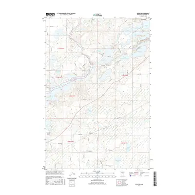
2016 Map of Riverton
USGS Topo · Published 2016About this map
The Mississippi River carves a winding path through this central Minnesota landscape, defining the western reaches of the Cuyuna Range area. The settlement of Riverton sits at the heart of a lake-dense terrain, surrounded by bodies of water like Little Rabbit Lake and Spruce Lake. The region's industrial heritage is subtly signaled by thoroughfares such as Portsmouth Mine Rd near Blackhoof Lake, while the northern edge touches the community of Trommald. To the south, the landscape transitions into more open wetlands and smaller clusters of settlement around Loerch and Woodrow. This environment is characterized by an intricate network of water and marsh, with Hay Lake and Twin Island Lake dotting the southern interior. Modern infrastructure is represented by the Brainerd Lakes Regional Airport on the southwestern margin, showing the intersection of local aviation with the traditional lake-and-river geography.
Find a feature on this map
78 named features on this map. Tap any name to fly to it.
Don’t see what you’re looking for? This feature index may not catch every label — zoom into the map to look around manually.
Map Details
Editions of this 2016 Riverton Map
This is the sole edition of this map. No revisions or reprints were ever made.
Other maps of this area

1912 · Deerwood
USGS Topo · 1:62,500

1913 · Cuyuna
USGS Topo · 1:62,500

1914 · Deerwood
USGS Topo · 1:62,500

1915 · Cuyuna
USGS Topo · 1:62,500

1915 · Brainerd
USGS Topo · 1:62,500

1918 · Brainerd
USGS Topo · 1:62,500

1953 · Duluth
USGS Topo · 1:250,000

1953 · Brainerd
USGS Topo · 1:250,000

1957 · Brainerd
USGS Topo · 1:250,000

1958 · Brainerd
USGS Topo · 1:250,000