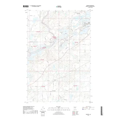
2019 Map of Riverton
USGS Topo · Published 2019About this map
Mississippi River and Rabbit River wind through the iron-rich landscape of Crow Wing County on this 2019 survey. The area is defined by its industrial heritage and complex hydrology, featuring the settlements of Ironton, Riverton, and Trommald. The terrain is marked by distinctive elevations such as Sidewinder Hill and Mucker Mountain, surrounded by a dense network of lakes including Blackhoof Lake, Little Rabbit Lake, and Portage Lake. This map reveals a community structured by its proximity to water and mineral wealth, with a road network that reflects the region's topography, seen in routes like Sagamore Rd and Co Hwy 59. Smaller hamlets like Loerch and Woodrow occupy the southern reaches, highlighting the scattered rural development typical of the Northwoods mining districts.
Find a feature on this map
84 named features on this map. Tap any name to fly to it.
Don’t see what you’re looking for? This feature index may not catch every label — zoom into the map to look around manually.
Map Details
Editions of this 2019 Riverton Map
This is the sole edition of this map. No revisions or reprints were ever made.
Other maps of this area

1912 · Deerwood
USGS Topo · 1:62,500

1913 · Cuyuna
USGS Topo · 1:62,500

1914 · Deerwood
USGS Topo · 1:62,500

1915 · Cuyuna
USGS Topo · 1:62,500

1915 · Brainerd
USGS Topo · 1:62,500

1918 · Brainerd
USGS Topo · 1:62,500

1953 · Duluth
USGS Topo · 1:250,000

1953 · Brainerd
USGS Topo · 1:250,000

1957 · Brainerd
USGS Topo · 1:250,000

1958 · Brainerd
USGS Topo · 1:250,000