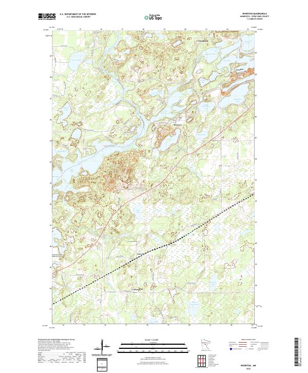
2022 Map of Riverton
USGS Topo · Published 2022About this map
The Mississippi River winds through this Minnesota landscape, defining a region where the iron mining legacy of the Cuyuna Range meets a complex network of glacial lakes. In the northeast, the settlements of Ironton and Trommald sit adjacent to Mountain Pits, marking the industrial history that shaped these communities. The central village of Riverton is positioned between Little Rabbit Lake and the river, connected to the surrounding terrain by the Cuyuna Lakes State Trl and a dense web of local paths like the Klondyke Trl and Syracuse Trl. To the south, the smaller localities of Loerch and Woodrow appear near the Brainerd Lakes Regional Airport, where the land transitions into a patchwork of wetlands and smaller water bodies such as Twin Island Lake and Hoppy Lake. This 2022 survey captures the contemporary balance between recreational trails and the physical scars of historic extraction.
Find a feature on this map
89 named features on this map. Tap any name to fly to it.
Don’t see what you’re looking for? This feature index may not catch every label — zoom into the map to look around manually.
Map Details
Editions of this 2022 Riverton Map
This is the sole edition of this map. No revisions or reprints were ever made.
Other maps of this area

1912 · Deerwood
USGS Topo · 1:62,500

1913 · Cuyuna
USGS Topo · 1:62,500

1914 · Deerwood
USGS Topo · 1:62,500

1915 · Cuyuna
USGS Topo · 1:62,500

1915 · Brainerd
USGS Topo · 1:62,500

1918 · Brainerd
USGS Topo · 1:62,500

1953 · Duluth
USGS Topo · 1:250,000

1953 · Brainerd
USGS Topo · 1:250,000

1957 · Brainerd
USGS Topo · 1:250,000

1958 · Brainerd
USGS Topo · 1:250,000