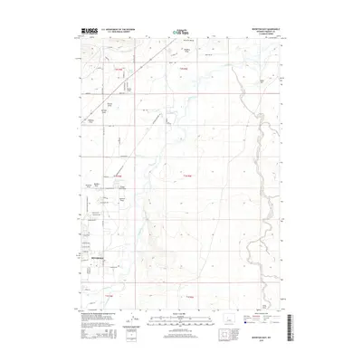
2015 Map of Riverton East
USGS Topo · Published 2015About this map
The Wind River and Little Wind River converge south of the city, defining a landscape shaped by irrigation and civic development. This mid-2010s survey captures the agricultural and institutional footprint of the region, specifically noted by the large tract of the Wyoming Penitentiary Farm and the associated Prison Farm Draw. The infrastructure of the high desert is visible through the Riverton Number 2 Canal, which feeds the northern sections of Riverton Valley. Numerous dry features such as Albright Draw, Shriner Draw, and Doughty Draw dissect the terrain, leading toward the river basins. The street grid of eastern Riverton is well-established, showing the transition from residential areas to the surrounding drainage networks including Ice Slough and Rush Slough.
Find a feature on this map
65 named features on this map. Tap any name to fly to it.
Don’t see what you’re looking for? This feature index may not catch every label — zoom into the map to look around manually.
Map Details
Editions of this 2015 Riverton East Map
This is the sole edition of this map. No revisions or reprints were ever made.
Other maps of this area

1950 · Riverton East
USGS Topo · 1:24,000

1951 · Indian Butte
USGS Topo · 1:24,000

1951 · Hidden Valley
USGS Topo · 1:24,000

1951 · Riverton West
USGS Topo · 1:24,000

1952 · Riverton NE
USGS Topo · 1:24,000

1952 · Lost Wells Butte
USGS Topo · 1:24,000

1953 · Arapahoe NE
USGS Topo · 1:24,000

1953 · Arapahoe
USGS Topo · 1:24,000

1955 · Thermopolis
USGS Topo · 1:250,000

1955 · Lander
USGS Topo · 1:250,000