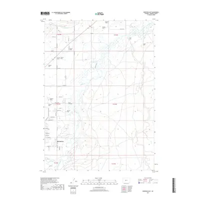
2017 Map of Riverton East
USGS Topo · Published 2017About this map
Riverton and the surrounding agricultural valley are defined by an intricate network of irrigation and drainage features essential to the high desert landscape. The Wind River and Little Wind River converge in the southern portion of the quadrangle, creating a complex wetland environment that contrasts with the many dry draws, such as Doughty Draw and Kirby Draw, that score the upland terrain. To the north and east, human engineering is visible in the Riverton Number 2 Canal and Rush Slough, which divert water to sustain the local settlement and farms.
Find a feature on this map
60 named features on this map. Tap any name to fly to it.
Don’t see what you’re looking for? This feature index may not catch every label — zoom into the map to look around manually.
Map Details
Editions of this 2017 Riverton East Map
This is the sole edition of this map. No revisions or reprints were ever made.
Other maps of this area

1950 · Riverton East
USGS Topo · 1:24,000

1951 · Indian Butte
USGS Topo · 1:24,000

1951 · Hidden Valley
USGS Topo · 1:24,000

1951 · Riverton West
USGS Topo · 1:24,000

1952 · Riverton NE
USGS Topo · 1:24,000

1952 · Lost Wells Butte
USGS Topo · 1:24,000

1953 · Arapahoe NE
USGS Topo · 1:24,000

1953 · Arapahoe
USGS Topo · 1:24,000

1955 · Thermopolis
USGS Topo · 1:250,000

1955 · Lander
USGS Topo · 1:250,000