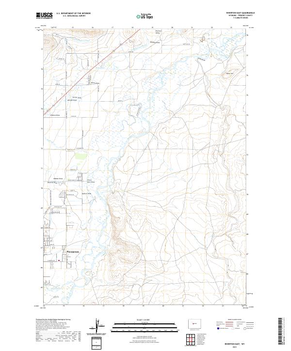
2021 Map of Riverton East
USGS Topo · Published 2021About this map
The Wind River and Little Wind River converge south of the city of Riverton, shaping a landscape defined by an extensive network of irrigation and correctional land use. The Wyoming Central Canal and Riverton Number 2 Canal highlight the region's historical reliance on water management for agriculture in this high basin. A significant portion of the riverfront and adjacent draws, such as Prison Farm Draw and Spencer Draw, is occupied by the Wyoming Penitentiary Farm, illustrating a unique pattern of institutional land management. Local topography is marked by several named drainage systems including Doughty Draw, Brown Draw, and Albright Draw, which cut through the terrain toward the river valley. Residential and agricultural development is concentrated along corridors like Hutchinson Rd and N Smith Rd, while Neble Hill stands as a prominent landmark overlooking the eastern bends of the river.
Find a feature on this map
61 named features on this map. Tap any name to fly to it.
Don’t see what you’re looking for? This feature index may not catch every label — zoom into the map to look around manually.
Map Details
Editions of this 2021 Riverton East Map
This is the sole edition of this map. No revisions or reprints were ever made.
Other maps of this area

1950 · Riverton East
USGS Topo · 1:24,000

1951 · Indian Butte
USGS Topo · 1:24,000

1951 · Hidden Valley
USGS Topo · 1:24,000

1951 · Riverton West
USGS Topo · 1:24,000

1952 · Riverton NE
USGS Topo · 1:24,000

1952 · Lost Wells Butte
USGS Topo · 1:24,000

1953 · Arapahoe NE
USGS Topo · 1:24,000

1953 · Arapahoe
USGS Topo · 1:24,000

1955 · Thermopolis
USGS Topo · 1:250,000

1955 · Lander
USGS Topo · 1:250,000