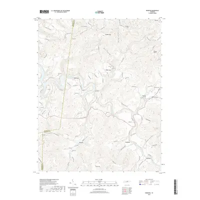
2019 Map of Riverton
USGS Topo · Published 2019About this map
The East Fork Obey River carves a deep, winding path through the borderlands of Fentress and Pickett counties, dictating the settlement patterns of this highland landscape. Along the river's sinuous Goose Neck, small communities such as Riverton, Manson, and Boatland are situated in the narrow valleys, connected by a network of rural roads that navigate the steep elevation changes. This terrain is characterized by prominent peaks like Skinner Mtn and Reynolds Mtn, while deep ravines like Dark Hollow and Taylor Hollow segment the land. The map is particularly notable for its density of burial sites, including the Robbinstown Cem, Beattytown Cem, and Dungan Cem, which offer significant value for genealogists tracing family names through these Tennessee hollows. Small hamlets like Little Crab and Helena mark the eastern reaches, where numerous branches and creeks, such as Buffalo Cove Creek, feed into the primary river system.
Find a feature on this map
94 named features on this map. Tap any name to fly to it.
Don’t see what you’re looking for? This feature index may not catch every label — zoom into the map to look around manually.
Map Details
Editions of this 2019 Riverton Map
This is the sole edition of this map. No revisions or reprints were ever made.
Other maps of this area

1895 · Wartburg
USGS Topo · 1:125,000

1896 · Wartburg
USGS Topo · 1:125,000

1897 · Standingstone
USGS Topo · 1:125,000

1898 · Standingstone
USGS Topo · 1:125,000

1929 · Byrdstown
USGS Topo · 1:62,500

1934 · Pall Mall
USGS Topo · 1:62,500

1954 · Crawford
USGS Topo · 1:24,000

1954 · Jamestown
USGS Topo · 1:24,000

1954 · Grimsley
USGS Topo · 1:24,000
1954 · Pall Mall
USGS Topo · 1:24,000