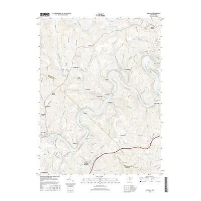
2016 Map of Rivesville
USGS Topo · Published 2016About this map
The Monongahela River carves a deep, winding path through this portion of northern West Virginia, where the legacy of industrial energy production meets established hill-country settlements. The landscape is defined by the transition from active extraction to modern reclamation, evidenced by the Loar Acid Mine Drainage Treatment Lake near Laurel Point and the Consol Number 93 Impoundment south of Jordan. Along the riverbanks, the Mon River Rail-Trail occupies former rail corridors that once served the mines and communities like Hilderbrand and Opekiska. Genealogists will find a network of rural burial grounds, including Snider Cem and Pisgah Cem, while the southern reaches of the map show the northward expansion of Fairmont near Viola and Mount Harmony. The terrain is deeply dissected by numerous hollows and runs, such as Flaggy Meadow Run and Toms Run, which dictated the winding course of early roads like Fairmont Rd.
Find a feature on this map
99 named features on this map. Tap any name to fly to it.
Don’t see what you’re looking for? This feature index may not catch every label — zoom into the map to look around manually.
Map Details
Editions of this 2016 Rivesville Map
This is the sole edition of this map. No revisions or reprints were ever made.
Other maps of this area

1886 · St. George
USGS Topo · 1:125,000

1891 · St. George
USGS Topo · 1:125,000

1902 · Fairmont
USGS Topo · 1:62,500

1902 · Morgantown
USGS Topo · 1:62,500

1904 · Blacksville
USGS Topo · 1:62,500

1907 · Thornton
USGS Topo · 1:62,500

1923 · Blacksville
USGS Topo · 1:62,500

1923 · Fairmont
USGS Topo · 1:62,500

1925 · Blacksville
USGS Topo · 1:62,500

1925 · Morgantown
USGS Topo · 1:62,500