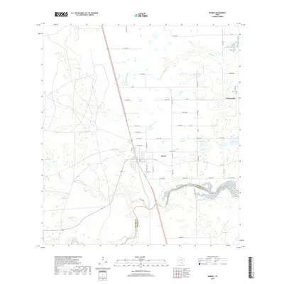
2019 Map of Riviera
USGS Topo · Published 2019About this map
Riviera serves as the primary hub of this South Texas coastal plain landscape, situated along a network of state and county roads. To the northeast, the small community of Vattmannville is anchored by the Vattmann Cem, reflecting the early 20th-century Catholic settlement history of the region. The terrain is defined by an intricate system of ephemeral watercourses and shallow basins, including Radicha Creek and the meandering Los Olmos Creek, which forms part of the boundary between Kleberg and Kenedy Counties.
Find a feature on this map
53 named features on this map. Tap any name to fly to it.
Don’t see what you’re looking for? This feature index may not catch every label — zoom into the map to look around manually.
Map Details
Editions of this 2019 Riviera Map
This is the sole edition of this map. No revisions or reprints were ever made.
Other maps of this area

1928 · Sarita
USGS Topo · 1:125,000

1950 · Corpus Christi
USGS Topo · 1:250,000

1952 · Riviera Beach
USGS Topo · 1:24,000

1952 · La Parra Ranch
USGS Topo · 1:24,000

1952 · Riviera Beach NW
USGS Topo · 1:24,000

1952 · Riviera Beach
USGS Topo · 1:62,500

1954 · Sarita
USGS Topo · 1:62,500

1954 · Riviera
USGS Topo · 1:62,500
1955 · La Parra Ranch
USGS Topo · 1:62,500

1956 · Corpus Christi
USGS Topo · 1:250,000