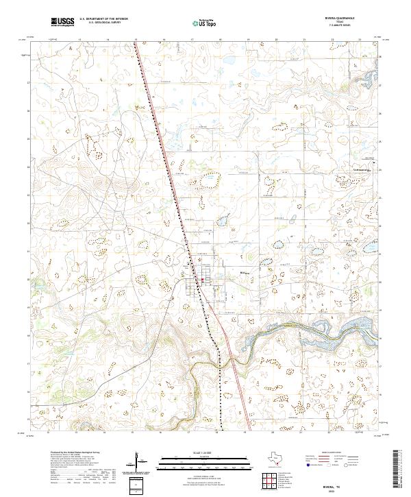
2022 Map of Riviera
USGS Topo · Published 2022About this map
The town of Riviera serves as the focal point of this South Texas survey, situated where the Kleberg-Kenedy county line follows the winding course of Los Olmos Creek. The landscape is defined by its subtle drainage patterns and coastal prairie lakes, including Araña Lake, Rosita Lake, and Boveda Lake. To the northeast, the small community of Vattmannville is visible, centered around Our Lady of Consolation Cem. This region's rural character is preserved through a network of farm-to-market roads and county routes that navigate between seasonal water bodies like Radicha Creek and the Seth Waterhole. The map provides a clear view of the local infrastructure serving these agricultural communities, from the Riviera Cem to the local post office, reflecting the area's enduring spatial organization.
Find a feature on this map
51 named features on this map. Tap any name to fly to it.
Don’t see what you’re looking for? This feature index may not catch every label — zoom into the map to look around manually.
Map Details
Editions of this 2022 Riviera Map
This is the sole edition of this map. No revisions or reprints were ever made.
Other maps of this area

1928 · Sarita
USGS Topo · 1:125,000

1950 · Corpus Christi
USGS Topo · 1:250,000

1952 · Riviera Beach
USGS Topo · 1:24,000

1952 · La Parra Ranch
USGS Topo · 1:24,000

1952 · Riviera Beach NW
USGS Topo · 1:24,000

1952 · Riviera Beach
USGS Topo · 1:62,500

1954 · Sarita
USGS Topo · 1:62,500

1954 · Riviera
USGS Topo · 1:62,500
1955 · La Parra Ranch
USGS Topo · 1:62,500

1956 · Corpus Christi
USGS Topo · 1:250,000