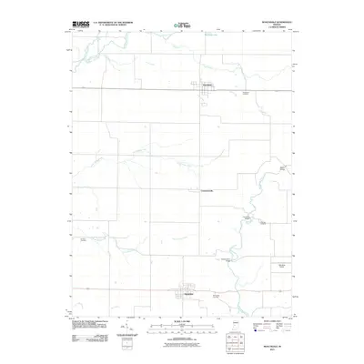
2011 Map of Roachdale
USGS Topo · Published 2011About this map
Roachdale and Bainbridge anchor this portion of northern Putnam County, representing a landscape defined by organized rural settlement and an intricate network of waterways. The northern reach is dominated by the course of Big Raccoon Creek and Lick Creek, while the southern half of the map features the winding paths of Big Walnut Creek and its various tributaries like North Ramp Creek and South Ramp Creek. Several bridge crossings, including the Rolling Stone Bridge and Pine Bluff Bridge, indicate the historic importance of traversing these waterways for local commerce between small communities like Carpentersville. For genealogists, the map preserves the locations of numerous family-named burial grounds, such as Hartman Cemetery and Coffman Cemetery, which sit alongside larger municipal sites like the Roachdale Cemetery.
Find a feature on this map
21 named features on this map. Tap any name to fly to it.
Don’t see what you’re looking for? This feature index may not catch every label — zoom into the map to look around manually.
Map Details
Editions of this 2011 Roachdale Map
This is the sole edition of this map. No revisions or reprints were ever made.
Other maps of this area

1951 · Clinton Falls
USGS Topo · 1:24,000

1953 · Indianapolis
USGS Topo · 1:250,000

1955 · Russellville
USGS Topo · 1:24,000

1956 · Indianapolis
USGS Topo · 1:250,000

1956 · New Market
USGS Topo · 1:24,000

1957 · Indianapolis
USGS Topo · 1:250,000

1957 · New Ross
USGS Topo · 1:24,000

1958 · Roachdale
USGS Topo · 1:24,000

1958 · Ladoga
USGS Topo · 1:24,000

1958 · Coatesville
USGS Topo · 1:24,000