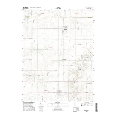
2016 Map of Roachdale
USGS Topo · Published 2016About this map
Roachdale and Bainbridge anchor this portion of northern Putnam County, representing the settled hubs of a landscape deeply defined by the drainage networks of Big Walnut Creek and Big Raccoon Creek. The map shows a transition from the structured grid of town streets, such as Railroad St and College St, to the winding riparian corridors where historic infrastructure is still documented. Notable river crossings like the Pine Bluff Bridge, Rolling Stone Bridge, and Higgins Bridge indicate the importance of established travel routes over the local waterways. Genealogists will find a series of family and community burial grounds, including Hartman Cem and Coffman Cem, situated between the larger settlements and the smaller hamlet of Carpentersville. The inclusion of the Way West Airport and the complex county road system reflects the intersection of early twentieth-century rural settlement patterns with modern transportation needs.
Find a feature on this map
59 named features on this map. Tap any name to fly to it.
Don’t see what you’re looking for? This feature index may not catch every label — zoom into the map to look around manually.
Map Details
Editions of this 2016 Roachdale Map
This is the sole edition of this map. No revisions or reprints were ever made.
Other maps of this area

1951 · Clinton Falls
USGS Topo · 1:24,000

1953 · Indianapolis
USGS Topo · 1:250,000

1955 · Russellville
USGS Topo · 1:24,000

1956 · Indianapolis
USGS Topo · 1:250,000

1956 · New Market
USGS Topo · 1:24,000

1957 · Indianapolis
USGS Topo · 1:250,000

1957 · New Ross
USGS Topo · 1:24,000

1958 · Roachdale
USGS Topo · 1:24,000

1958 · Ladoga
USGS Topo · 1:24,000

1958 · Coatesville
USGS Topo · 1:24,000