
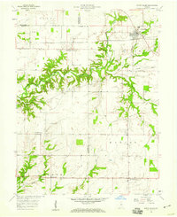
1958 Map of Roachdale
USGS Topo · Published 1959About this map
Roachdale serves as a central rail junction in northern Putnam County during the late 1950s, where the Baltimore and Ohio and Monon lines intersect. This railroad-driven landscape transitions into agricultural acreage to the south, anchored by the town of Bainbridge. A notable transportation corridor is the Ernie Pyle Memorial Highway, which crosses the southern half of the quadrangle, reflecting local honors for the famed war correspondent from the region.
Find a feature on this map
38 named features on this map. Tap any name to fly to it.
Don’t see what you’re looking for? This feature index may not catch every label — zoom into the map to look around manually.
Map Details
Editions of this 1958 Roachdale Map
This is the sole edition of this map. No revisions or reprints were ever made.
Other maps of this area

1951 · Clinton Falls
USGS Topo · 1:24,000

1953 · Indianapolis
USGS Topo · 1:250,000

1955 · Russellville
USGS Topo · 1:24,000

1956 · Indianapolis
USGS Topo · 1:250,000

1956 · New Market
USGS Topo · 1:24,000

1957 · Indianapolis
USGS Topo · 1:250,000

1957 · New Ross
USGS Topo · 1:24,000

1958 · Ladoga
USGS Topo · 1:24,000

1958 · Coatesville
USGS Topo · 1:24,000
1958 · North Salem
USGS Topo · 1:24,000