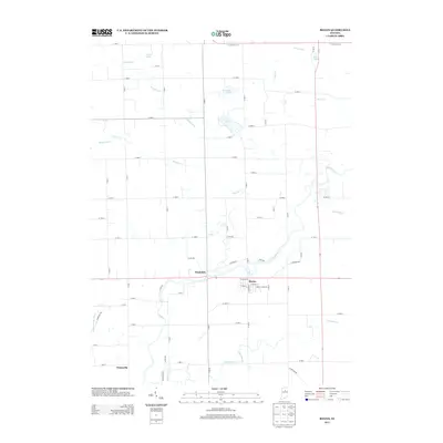
2013 Map of Roann
USGS Topo · Published 2013About this map
The Eel River defines the central geography of this Wabash County region, winding past the settlements of Stockdale and Roann. This 2013 survey illustrates a landscape deeply connected to its water drainage network, with several small lakes including Lukens Lake, McColley Lake, and Gaerte Lake concentrated in the northern portion of the quadrangle. The township structure is visible through a grid of numbered roads and local ditches like Craig Ditch and Bolley Ditch, which manage the flow toward the river valley. To the south, the village of Pettysville sits near the confluence of several small tributaries, while Paw Paw Cr and Beargrass Cr drain the eastern and southern reaches. The road network, including W State Road 114 and River Rd, provides a clear view of how these small Indiana communities remain oriented toward the river's path.
Find a feature on this map
71 named features on this map. Tap any name to fly to it.
Don’t see what you’re looking for? This feature index may not catch every label — zoom into the map to look around manually.
Map Details
Editions of this 2013 Roann Map
This is the sole edition of this map. No revisions or reprints were ever made.
Other maps of this area

1951 · Peru
USGS Topo · 1:24,000

1951 · Richvalley
USGS Topo · 1:24,000

1952 · Wabash
USGS Topo · 1:24,000

1953 · Fort Wayne
USGS Topo · 1:250,000

1953 · Chicago
USGS Topo · 1:250,000

1953 · Danville
USGS Topo · 1:250,000

1953 · Muncie
USGS Topo · 1:250,000

1955 · Danville
USGS Topo · 1:250,000

1956 · Muncie
USGS Topo · 1:250,000

1956 · Danville
USGS Topo · 1:250,000