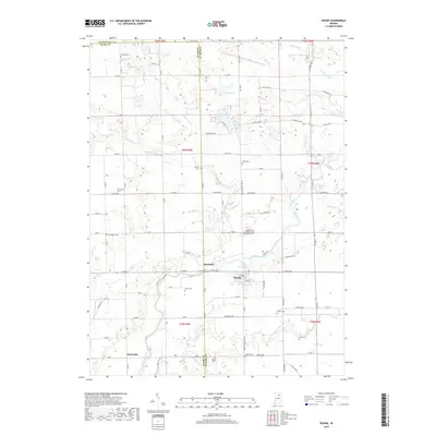
2019 Map of Roann
USGS Topo · Published 2019About this map
The Eel River winds through the heart of northern Indiana's agricultural landscape, anchoring the historic riverside settlements of Roann and Stockdale. This 2019 survey documents a region defined by an intricate network of drainage ditches and creeks, including Squirrel Creek, Paw Paw Creek, and Beargrass Creek, which manage the water levels of the surrounding farmland. Numerous small cemeteries, such as Finley Cemetery, Shiloh Cemetery, and the Independent Order of Odd Fellows Cemetery, are preserved across the landscape, offering vital touchpoints for genealogical research and local heritage. Small bodies of water like Lukens Lake, McColley Lake, and Gaerte Lake punctuate the northern sections of the map near the Miami and Wabash county lines, while the southern reaches include the community of Pettysville.
Find a feature on this map
81 named features on this map. Tap any name to fly to it.
Don’t see what you’re looking for? This feature index may not catch every label — zoom into the map to look around manually.
Map Details
Editions of this 2019 Roann Map
This is the sole edition of this map. No revisions or reprints were ever made.
Other maps of this area

1951 · Peru
USGS Topo · 1:24,000

1951 · Richvalley
USGS Topo · 1:24,000

1952 · Wabash
USGS Topo · 1:24,000

1953 · Fort Wayne
USGS Topo · 1:250,000

1953 · Chicago
USGS Topo · 1:250,000

1953 · Danville
USGS Topo · 1:250,000

1953 · Muncie
USGS Topo · 1:250,000

1955 · Danville
USGS Topo · 1:250,000

1956 · Muncie
USGS Topo · 1:250,000

1956 · Danville
USGS Topo · 1:250,000