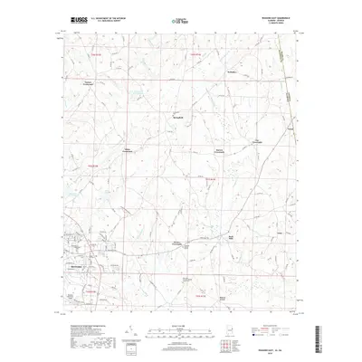
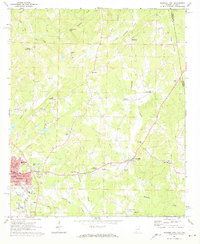
2018 Map of Roanoke East
USGS Topo · Published 2018About this map
Roanoke serves as the focal point for this Alabama-Georgia borderlands survey, where the rolling hills of Randolph County meet the state line. The landscape is defined by a dense network of creeks, including Wehadkee Cr and its tributaries, which flow through a region marked by agricultural crossroads like Taylors Crossroads and White Crossroads. This area preserves several family and community burial grounds, such as the Old Salem Primitive Baptist Church Cem and Booger Hill Cem, providing a direct link to the region's early rural heritage. The mapping reveals a transition from the municipal development surrounding the Roanoke Municipal Airport to the east, where the terrain descends toward High Shoals Falls and the settlement of Rock Mills, illustrating the persistent rural character of the Piedmont upland at the turn of the 21st century.
Find a feature on this map
140 named features on this map. Tap any name to fly to it.
Don’t see what you’re looking for? This feature index may not catch every label — zoom into the map to look around manually.
Map Details
Editions of this 2018 Roanoke East Map
This is the sole edition of this map. No revisions or reprints were ever made.
Other maps of this area

1899 · Wedowee
USGS Topo · 1:125,000

1902 · Wedowee
USGS Topo · 1:125,000

1953 · Atlanta
USGS Topo · 1:250,000

1957 · Atlanta
USGS Topo · 1:250,000

1958 · Atlanta
USGS Topo · 1:250,000
1964 · Abbottsford
USGS Topo · 1:24,000

1964 · Glenn
USGS Topo · 1:24,000
1964 · Frolona
USGS Topo · 1:24,000
1968 · Five Points
USGS Topo · 1:24,000
1969 · Roanoke East
USGS Topo · 1:24,000