
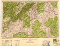
1947 Map of Roanoke
USGS Topo · Published 1948About this map
The Blue Ridge Mountains and Allegheny Mountains form a massive topographic spine across this post-war landscape, where the ridge-and-valley terrain meets the rolling Piedmont. Major industrial and transit hubs like Roanoke and Lynchburg anchor the region, served by a dense network of major rail lines including the Norfolk & Western RR and the Chesapeake & Ohio RR. These rails follow the natural corridors carved by the James River and the Roanoke River, highlighting the era's reliance on river-gap geography for commerce.
Find a feature on this map
219 named features on this map. Tap any name to fly to it.
Don’t see what you’re looking for? This feature index may not catch every label — zoom into the map to look around manually.
Map Details
Editions of this 1947 Roanoke Map
2 editions found
Other maps of this area

1887 · Spottsylvania
USGS Topo · 1:125,000

1887 · Lewisburg
USGS Topo · 1:125,000

1890 · Goochland
USGS Topo · 1:125,000

1890 · Roanoke
USGS Topo · 1:125,000

1890 · Christiansburg
USGS Topo · 1:125,000

1891 · Roanoke
USGS Topo · 1:125,000

1891 · Palmyra
USGS Topo · 1:125,000

1891 · Farmville
USGS Topo · 1:125,000

1891 · Lewisburg
USGS Topo · 1:125,000

1891 · Huntersville
USGS Topo · 1:125,000